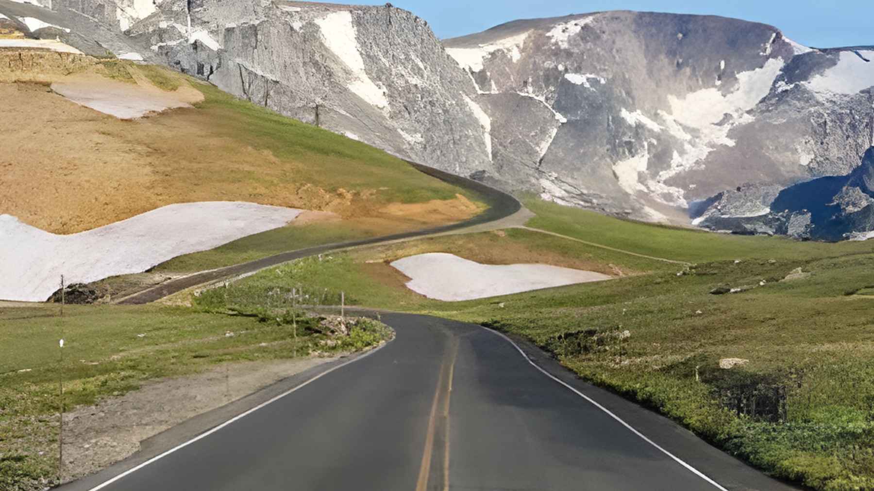
If you are aiming for Yellowstone and you think the drive is just a way to “get there,” the Beartooth Highway has other ideas. This 68-mile stretch of U.S. 212 climbs into the Beartooth Mountains, tops out at 10,947 feet at Beartooth Pass, and has become famous enough to be labeled “the most beautiful roadway in America” in recent travel coverage.
But here’s the part many itineraries miss. The same elevation that delivers that wide-open, above-the-treeline view also creates a short season, sudden closures, and the kind of conditions that can make even the best travel app look clueless. Treat it like a destination, not a shortcut, and it becomes the highlight of the trip.
Why this road is a destination
The federal government’s “All-American Road” label is not a throwaway compliment. The Federal Highway Administration says an All-American Road has nationally significant qualities and “one-of-a-kind features,” and it must be a “destination unto itself,” meaning the drive is a primary reason to travel.
Beartooth Highway fits that definition on paper and on the windshield. It connects Red Lodge, Montana, to Cooke City, Montana, and serves as a scenic approach to Yellowstone’s Northeast Entrance near Silver Gate. Along the way, the climb and the exposure change the landscape fast, from valley views to high tundra.
And it is not built for speed, even if your GPS says otherwise. The U.S. Forest Service notes the drive can take a minimum of two to three hours, and that is before you stop for pullouts, short hikes, or the inevitable photo break when the road bends and the horizon suddenly expands.
The short season problem
This is a mountain highway that behaves like one. Montana’s Department of Transportation says the road is generally open from the Friday of Memorial Day weekend through mid-October, weather permitting, and it can see temporary closures throughout the summer because conditions change quickly at high elevations.
Yellowstone’s own road guidance echoes the same reality and points travelers to state road tools for last-minute checks. The National Park Service also flags that after initial opening, weather can still shut things down, which matters if you are trying to hit a hotel reservation window inside the park.
Locals quoted by Travel + Leisure are blunt about timing. Shop owner Marci Dye says July and August are typically the sweet spot, while June and September can still bring snow-related closures and unpredictable weather, and she warns that the top of the pass can run 20 to 30 degrees cooler than Red Lodge. Bring the jacket you thought you would not need in summer.
An economic lifeline for small towns
Scenic roads are not just pretty. They are seasonal business engines, especially when they funnel visitors through places like Red Lodge and Cooke City, where a busy summer weekend can carry a lot of weight for guides, lodging, restaurants, and gear shops.
Dye’s comments highlight something you can feel in real time on the ground, which is that the road’s appeal is tied to constant change. Snowbanks can linger, wildflowers shift every few weeks, and mountain goats may wander close enough to draw out every phone camera in the turnout.
That steady flow of “you have to see this” moments is also what keeps travelers spending time and money instead of blasting through.
One stop shows how practical the business side can be. The National Scenic Byway Foundation lists the Top of the World Store at about 9,400 feet, and says it offers food, fuel, gifts, and lodging, sitting roughly 38 miles from Red Lodge and 25 miles from Cooke City. In plain terms, it is where your gas gauge stops being theoretical.
When your phone lies
Here’s the tech twist that surprises people. Dye told Travel + Leisure that Google Maps and Apple Maps are “very often inaccurate,” sometimes showing closures when the highway is open and the reverse. Her advice is simple and old-school, which is to stop and ask a real person in Red Lodge or Cooke City-Silver Gate for the latest conditions.
There is a structural reason this can get messy. Montana DOT says it maintains the highway to the Montana-Wyoming border, and the National Park Service takes over through Wyoming, back into Montana, and into Yellowstone. That cross-agency handoff can make “one source of truth” harder than travelers expect, especially during fast-changing weather.
So plan like you would for any high-stakes drive, even if it is a vacation. Check official road status before you leave, check again when you have signal, and build in a buffer so a temporary closure does not domino into missed tours or lost lodging deposits.
Stops that change the whole drive
The road rewards the people who pull over. Travel + Leisure notes there are many small pullouts, often with informational signs about the area’s history, geology, and wildlife, and the Forest Service also highlights the corridor’s mix of scenic pullouts and day hikes. It is designed for pauses.
If you want easy wins, the suggestions are surprisingly practical. Akio Joy recommends Vista Point on the climb from Red Lodge and a short walk to a Rock Creek viewpoint, and he also points to quick options like Twin Lakes near the state line or a loop around Island Lake.
These are the kinds of stops that turn “68 miles” into a half-day you will actually remember.
For bigger views, the National Scenic Byway Foundation lists the Clay Butte Fire Lookout Tower at 9,811 feet, reached by a three-mile drive on a gravel road, and the Pilot and Index Peak Overlook at 8,718 feet, which it says ranks in the top ten most often photographed scenes along the road.
Just remember Dye’s reminder, which is that this is not a zoo and wildlife needs distance, even when it wanders close.
Connecting to Yellowstone without rushing
A common Yellowstone planning mistake is trying to “squeeze” Beartooth Pass between two packed park days. Joy told Travel + Leisure that the biggest error is attempting the pass right before or after an “unforgettable day” in Yellowstone, instead of slowing down, enjoying Red Lodge or Cooke City, and giving the drive its own time.
Timing is part safety, part experience. Joy talks up sunrise for quiet roads and alpenglow, and Dye likes late afternoon into early evening for golden light, but both approaches only work if you are not racing a schedule. The National Park Service also warns that even after seasonal opening, weather can cause occasional closures, so rigid plans can crack fast.
At the end of the day, Beartooth Highway is a reminder that America’s best infrastructure experiences are not always the fastest ones. Build slack into the plan, trust official updates over rumors, and you will get the road trip version of a jackpot.
“The official trip-planning guidance was published on the USDA Forest Service.